You’ll need your bog trotting skills as you take on this popular Peak District circular walk starting from Edale and incorporating the Pennine Way, Kinder Scout and notorious Kinder peat bogs! Sweeping views of the Edale valley and Great Ridge provide endless photo opportunities on this half day adventure in the heart of the National Park.
Walking Route – Kinder Scout from Edale via Pennine Way
Distance: 15.8km (9.8mi) / Elev Gain: 535m
High Point: Kinder Low - 633m
Map: OS Explorer OL1
GPS Download: Kinder Scout from Edale
Starting Point: Edale Car Park
Walk highlights include Edale village, Pennine Way, Jacobs Ladder, Edale Rocks, Kinder Low, Kinder Downfall, Kinder peat bogs and Grindsbrook Clough.
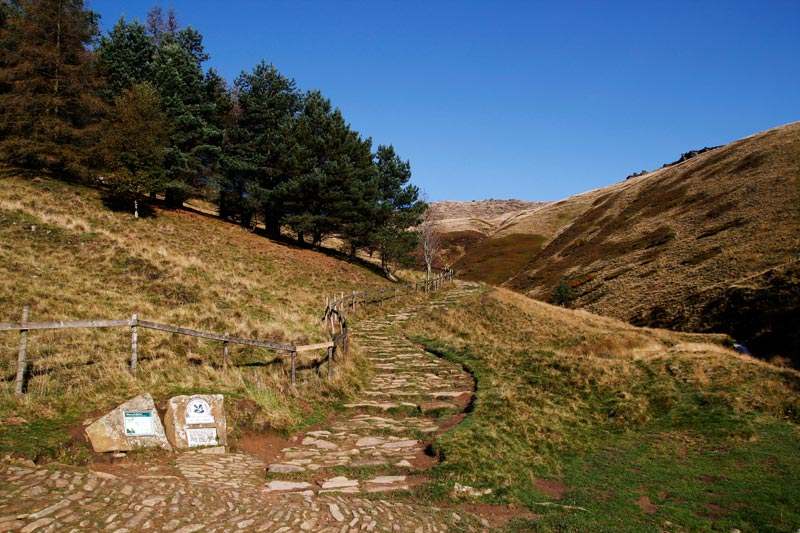
This walk begins at the official starting point of the Pennine Way long distance walking path in the village of Edale. A plaque on the outside of The Old Nags Head pub marks the spot, making it a good first photo opportunity of the day! From here the trail is way-marked and further signage confirms you are indeed about to start walking on the Pennine Way – which you’ll be following for approx 5.5 miles.
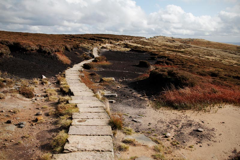
The loose stone path is well defined and soon leads to open farmland. Stone slabs dissect the undulating fields, the navigation takes care of itself allowing you to focus on the epic vistas all around. On a clear day its easy to get carried away taking photos here!
The trail descends for a period, passing by Upper Booth Farm Campsite, before eventually joining a narrow tarmac access road. The next landmark is Jacobs Ladder, you’ll cross a small stone bridge and be presented with two signed paths. The rough stone slabbed path to the right is the official Pennine Way route, and is the steeper and most direct to the top of Jacobs Ladder. Both meet at the top.
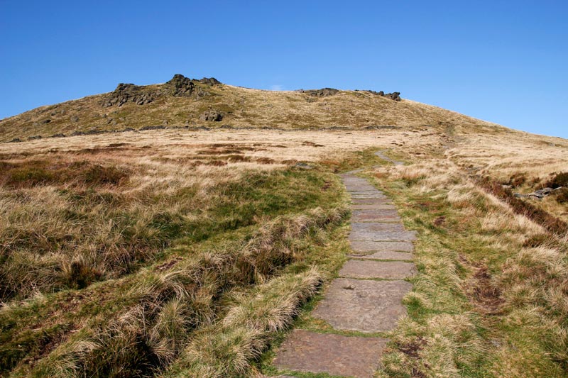
There is little respite as you continue the ascent up to the Kinder plateau. Here you are greeted by Edale Rocks, a distinctive rocky outcrop whose boulders invite you to scramble the short distance to the high point. Its quite exposed on the rocks and care should be taken on wet or windy days!
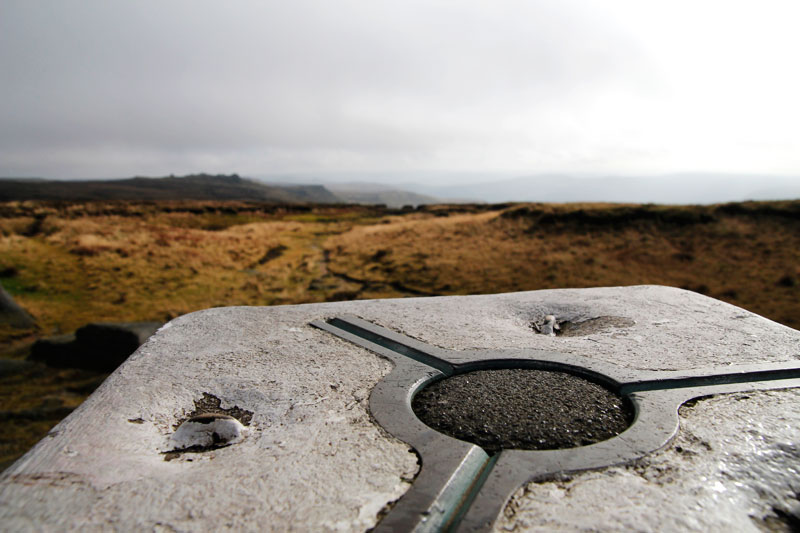
A short distance further on is the Kinder Low trig pillar, which at 633 metres is the high point of the day, and is regarded by many as the summit of Kinder Scout – though technically its not, albeit only by a mere 3 metres!
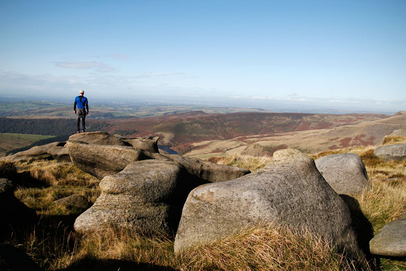
From Kinder Low the route traverses the edge of the Kinder plateau for almost 2 miles, the path is on the whole easy under foot although you’ll need to pick your way over and around small boulders in places. There are once again some good photo opportunities here including views of Kinder Reservoir.
Kinder Downfall is your next landmark, the waterfall can be a mere trickle or gushing torrent depending upon the volume of water flowing from the River Kinder. Although its actually difficult to visualise from the path as the plateau is effectively the top of the waterfall. A strong westerly can blow water back up and onto the plateau – an entertaining phenomenon should you experience it! The downfall is a popular lunch stop when walking from Edale and Hayfield, you’ll rarely be alone here.
From Kinder Downfall you say goodbye to the Pennine Way and hello to your bog trotting skills! A GPS and map/compass are highly recommended for the Kinder peat-land traverse, as the footpath marked on the map has long since eroded in parts.
You’ll follow the River Kinder upstream for approx 0.5 miles (staying to the right of the river bed seems to be the path of least resistance and where the majority of footprints lead), carefully navigating the unstable terrain – which in wet weather can and does become very boggy and somewhat hazardous.
This area is almost featureless and one can become easily disorientated, hence allow plenty of daylight for your crossing and be sure of your navigation skills. In winter conditions or during periods of prolonged wet weather the conditions underfoot can be hazardous due to the nature of the terrain.
Where the path forks on the map, you need to take the left-hand fork which heads in a SE direction (no longer following the River Kinder). On the ground I found the path to be non-existent here and needed a GPS to be confident I was where I wanted to be.
Navigation is once again challenging and some precarious looking peat-land features need to be passed, jumped over or avoided. The undulating terrain becomes increasingly heather-clad, and much to my relief I eventually found the ‘path’ once more!
With the path becoming more defined and the appearance of boulders its evident you’ve reached the ‘other side’. You’ll arrive at a rocky intersection of paths and another waterfall (Crowden Brook), similar to Kinder Downfall but on a smaller scale. Looming above and to your right is the impressive rock tower known as Crowden Tower. However you’ll head in the opposite direction, initially dropping before the wide rocky path levels out for approx 0.5 miles.
The views of the Edale valley and Great Ridge here are sublime, and if its a clear day its worth taking a few more photos before you begin the descent.
Grindsbrook Clough is a classic and popular grade 1 scramble, on this occasion down climbing the boulder strewn stream. The rocks are remarkedly grippy even in the wet. The steepest section is at the top, expect to use your hands and possibly a few bum slides may be required depending upon your choice of line! [If you don’t fancy Grindsbrook Clough you can continue along the plateau path and pick-up an alternate route, beyond Upper Tor.]
A defined path winds down through the beautiful and lush valley. A wooden foot bridge (which wouldn’t be out of place on a Hobbiton film set) leads to a small section of woodland.
Beyond the woodland you’ll pick-up a stone slabbed walkway which leads into Edale village at the back of the Old Nags Head pub. Finish up with a brew or perhaps something a little stronger before you head off home!
Further Info
Starting Point – The walks starts from the village of Edale, either the train station or main village car park (cash required). From either location head North along the main road past the Rambler Inn (on your left) and on to The Old Nags Head – the start of this walk and official starting point of the Pennine Way.
Other Notes – Edale gets busy all year round so arrive early on the weekend or during school holidays if you need to park. The Penny Pot Cafe is located by the station, and Coopers Cafe is close to The Old Nags Head pub at the start / end of the walk. There is also a small shop (limited opening hours) next door to Coopers. Camping in Edale village is possible at Fieldhead campsite or Coopers campsite. Edale is a small rural village and accessibility can be impacted by snow and ice in the winter – always check the forecast in advance and plan accordingly !
Hazards
Per above navigation over the Kinder bogs can be tricky as can the conditions underfoot. The descent down Grindsbrook clough is classified as a grade 1 scramble, which for the majority of walkers should be easy..
Remember – we cannot highlight all potential hazards when out in the great outdoors. Safety is ultimately down to you. Educate yourself in safety, weather reports, navigation and equipment specific to the activity you intend to undertake and conditions/terrain you may encounter! Check out adventuresmart.uk for general outdoor safety considerations – and activity specific guidance for hill walking, paddle boarding, mountain biking and open water swimming.