This 20 mile ride is a great introduction to the Peak District mountain biking scene, a demanding route with rocky descents, technical climbs and sections of hike a bike will leave you wanting more or vowing never to return again!
Ride highlights include Dirtlow rake, Hope Cross, Potato Alley, Hagg Farm, Jaggers Clough, Chapel Gate and Rushup Edge. Cafe stops in Hope and Edale.
Distance: 20mi / 32.2km / Elev Gain: 3,230ft / 985m
Navigation: GPX Download
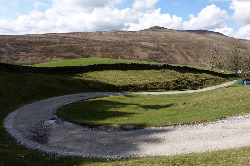
Starting point: Mam Nick Car Park
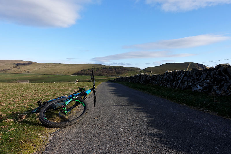
Sat Nav (nearest postcode): S33 8WA Parking: Mam Nick Car Park is free for National Trust members or Pay and display. Free limited lay-by parking opposite the car park.
[sgpx gpx=”/wp-content/uploads/gpx/Dark Peak Blast.gpx”]
This demanding ride is suitable for experienced riders, incorporating the beautiful and undulating Hope and Edale valleys. An optional extension down to the edge of Ladybower Reservoir takes the total distance of the ride to 20 miles, skip the extension to shorten it to 15 miles. If the ride wets your appetite, the longer Dark Peak XC Epic route may be natural next step to your exploration of the Peak District!
Ride Guide Details
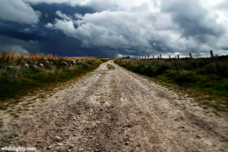
Starting from Mam Nick Car Park the ride begins on a section of tarmac, providing the perfect opportunity to test out the brakes and take in the surrounding views. If unfamiliar with the location, the looming peak close by is Mam Tor, and as well as the hoards of walkers, paragliders can often be seen floating in the surrounding skies above.
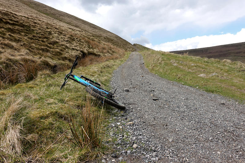
Past the turn for Winnats Pass (which leads down to Castleton), a farm gate (on the left) marks the start of the ride. There should be a sign for Rowter Farm (which also offers basic camping), along with a wooden ‘Public Footpath’ sign. A leisurely couple of miles over tarmac, gravel and loose-stone gets the legs fully warmed up ahead of the days first descent, and perhaps the most gnarly.
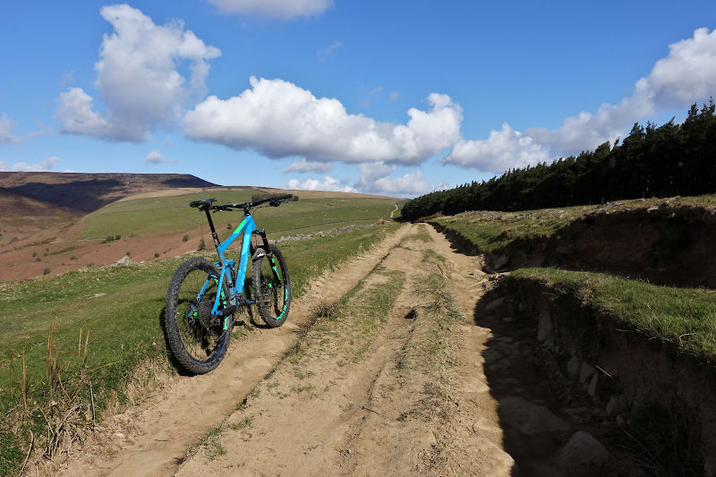
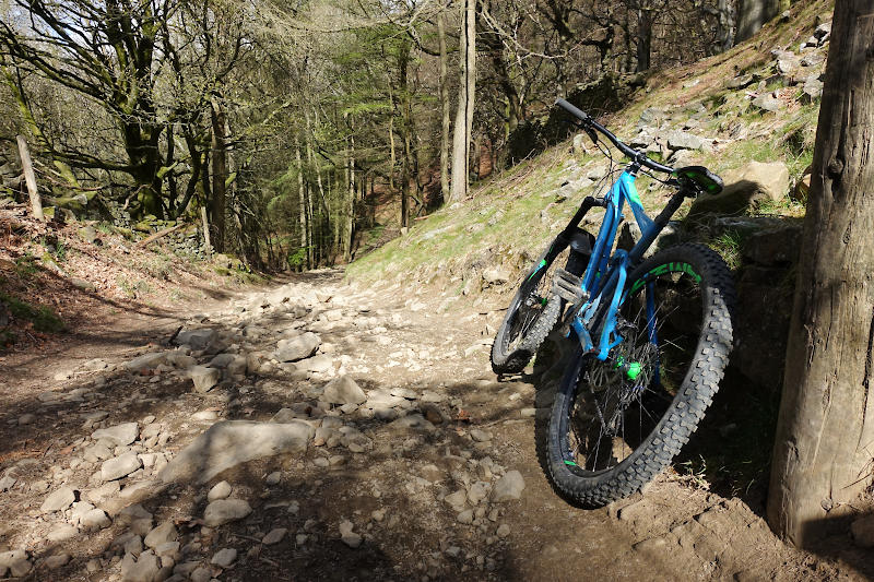
Dirtlow Rake is a fast and furious descent on what is a wide loose-rock strewn path. If you dare look up (or decide to stop) the views here are excellent, despite the blot on the landscape that is Hope cement factory! It is on this very descent I’ve had rocks smash into my shins on more than one occasion – so my advice is to wear shin pads!
Your bones will barely stop rattling on the short (initially tarmac) transition from Dirtlow Rake to Pindale. Its easy to zip past the right turn onto Pindale – a tree-lined gravel road which leads to the top of the descent.
Hold on tight as you swoop into the Pindale descent, which is chaotic and once again requires good bike control and laser like precision to avoid some pretty big and jutty rocks! You’ll pass beside a disused quarry before eventually joining the road – still Pindale Rd in fact!
A welcome section of fast tarmac passes by Pindale Farm Outdoor Centre, and over the River Noe, down into the village of Hope. Amenities in Hope include Grasshopper Café, Café Adventure and a Convenience store. A handy bike shop is also located in Hope, and you’ll go right past it – 18 bikes.
From Hope its an unremarkable mile or so along Edale Rd, before turning onto Fullwood Stile Ln, a single lane road signed as a dead-end. You’ll eventually join the Roman Rd, a bridleway which ramps up in gradient almost immediately and is initially pretty rocky – for some this will be the first hike a bike section of the day.
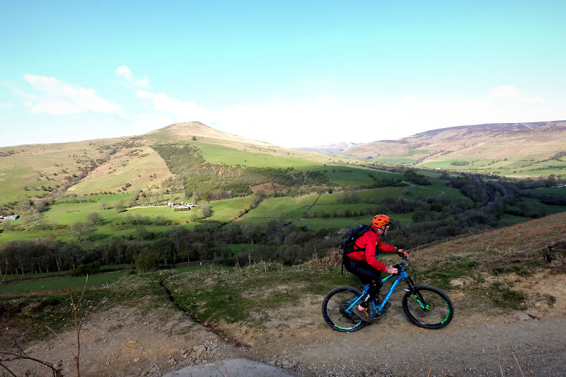
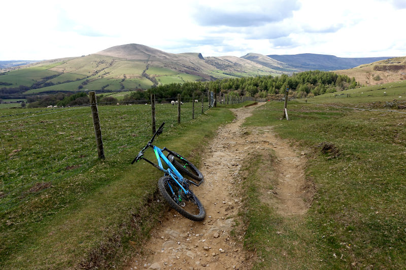
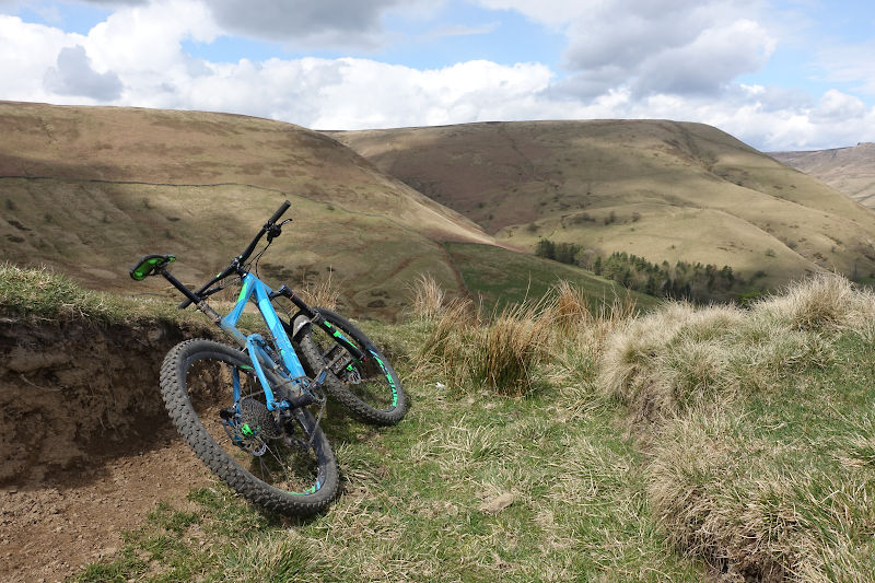
Reaching the plateau of the climb the path opens out and presents some epic views of the Edale valley. In dry conditions the riding here is fast and smooth, on a bluebird day it can feel akin to riding the lower reaches of an alpine trail (or is that overkill?)!
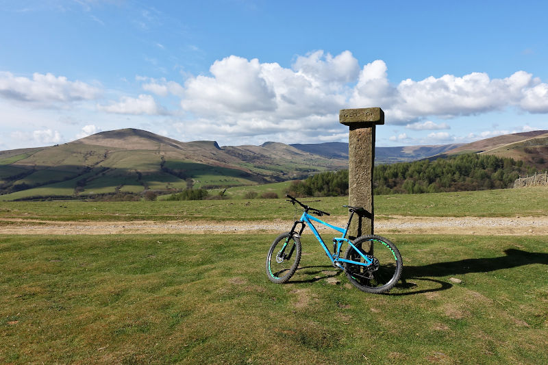
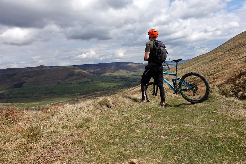
Hope Cross is somewhere I often stop to refuel and take a photo or ten. I have to admit I never quite understand what (or where) Hope cross is precisely. That said the OS map suggests the stone pillar is pretty much bang on, so despite it not being a cross that’s what I go with – certainly no-one has disagreed with me yet.
Its decision time at the distinctive crossroads, a hundred metres or so beyond Hope Cross. Turn left towards Edale (its well signed) – reducing the ride to 15 miles total, or continue on.
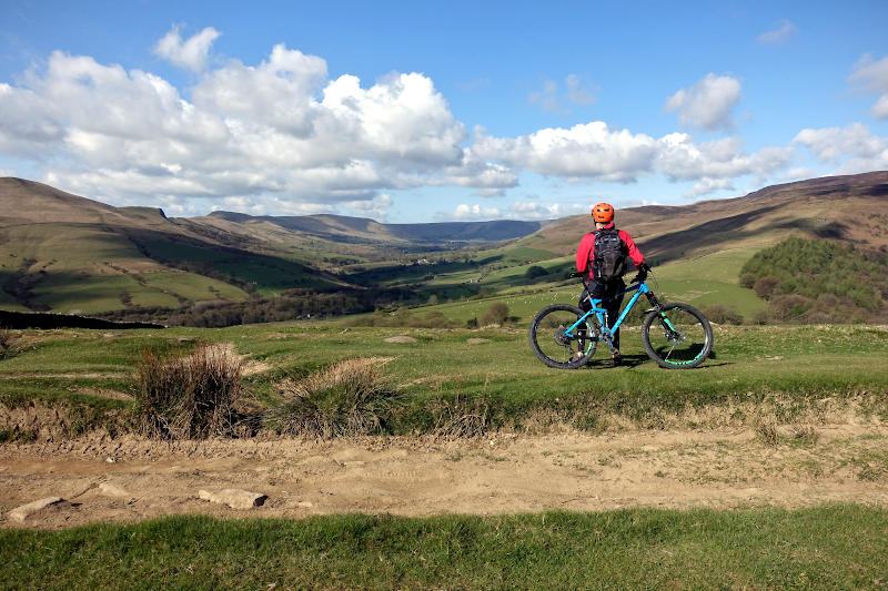
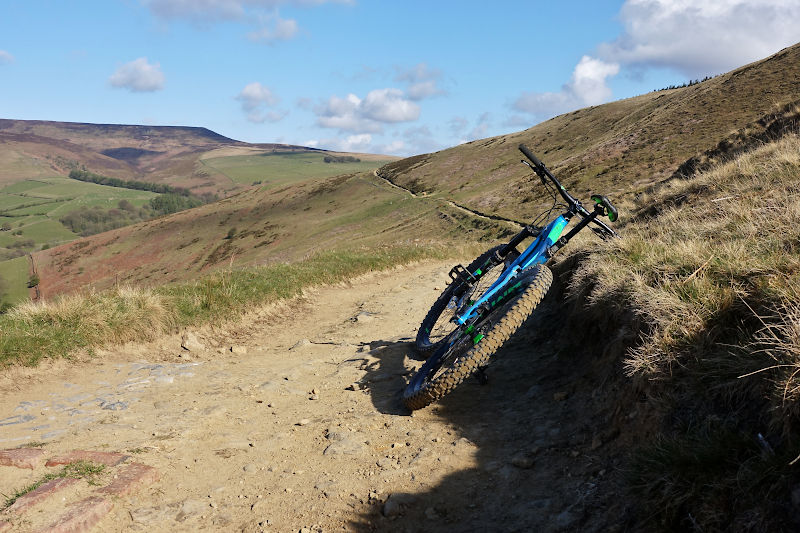
The route ahead sees you leave the Edale valley and quite possibly your comfort zone as you take on the Potato Alley descent. Rewarding views make way to a steep and rocky track which traverses moorland, the rock-strewn path resembles a field of freshly harvested potatoes – I assume giving the trail its name! The descent never gets super steep however its fast, energy sapping and gnarly in places!
What goes down must go up, and upon crossing the A57 (Snake Road) its’ the pretty hefty and winding Rowlee farm climb – which at this stage of the ride may leave the unfit cursing their decision not to take the shorter route to Edale, 15 mins earlier!
Next up is the Hagg farm descent, the pay off for the previous climb and one of the highlights of the day. You should be fully dialled in at this stage of the ride, nail the treelined winding descent (which has less rocks and therefore more traction than the previous descents) and you’ll have a beaming smile, and that feeling of satisfaction we all crave on these sorts of rides !
Back over Snake Road again the route crosses and runs parallel with the River Ashop, before a sharp right marks the beginning of a tough climb. This near 1 mile ascent through the forest will once again test your climbing stamina, which for me means its another (partial) hike a bike! The gradient abruptly eases at the top of the forest, and once emerges close to Hope Cross one more – the spot where you (stupidly?) elected to extend the ride, an hour (or more) earlier!
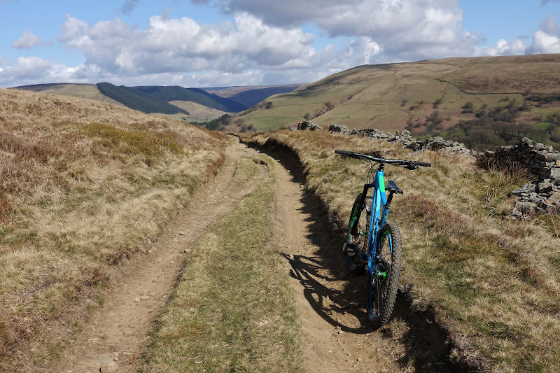
Back at the crossroads the path ahead towards Edale is known as Jaggers Clough. This smile inducing trail includes a mixture of fast steep descents and tough climbs – the sort of riding I love! You’ll eventually join a narrow path (look out for walkers), which rejoins Edale road once more.
An approx 2.5 mile yomp along Edale road is unavoidable but actually quite enjoyable – yes its tarmac but this is the Edale valley, its beautiful and the roads are generally quiet in my experience.
The ride doesn’t go directly through Edale village, however it’s a quick deviation – if you’re looking for a quick refuel I can recommend the Penny Pot café at the train station, they serve great coffee and tasty snacks!
From the hamlet of Barber Booth it’s a steep but thankfully (relatively) short climb before leaving the road, via a gated gravel/stone road on the right to join the infamous Chapel Gate path.
The path towards Chapel Gate starts off innocently enough, with sweeping views providing a real sense of being on an adventure ride. This is however the calm before the storm, for the terrain slowly but surely ramps up to what becomes a brutal and lung-busting 1.5 mile climb – I’ve done some climbs in my time, and this one sucks – its relentless and traction is in parts near impossible.
In fact it may be inaccurate to call it a climb, because for the vast majority (including me) this is hike a bike territory! On the plus side the views out to the Kinder plateau and back towards the Edale valley are sublime.
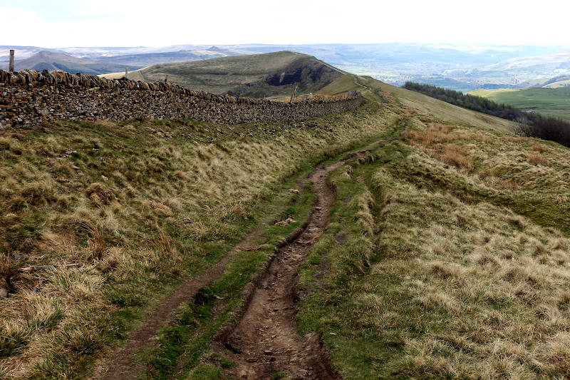
At the top of Chapel Gate it’s a left at the intersection, towards and onto Rushup Edge. The edge is undulating and fun, though a little rutted in places. It should be noted the bridleway and walking path do split off. Its easy to miss the tiny sign, the bridleway runs on the right of the wall. Both converge again for the final descent off the edge and onto road. It then just a case of rolling down the hill and back to the start!