Experience a double espresso of classic Peak District scenery on this moorland yomp around an often overlooked area of the national park.
Distance: 14km (8.7mi) / Elev Gain: 497m (1,632ft)
High Point: Black Hill - 582m
Map: OS Explorer OL1
GPS Download: Black Hill Circular From Crowden
Starting Point: Crowden Car Park
Walk Highlights
Black Hill had been on my to-do list for some time (being the third highest Peak District peak after Kinder Scout and Bleaklow), and in fact if it wasn’t for a road closure on the A57 Snake Pass on the day in question (I was planning an assault on Bleaklow and the B29 Plane Wreckage), this walk may well still be on said list!
The day’s focus quickly became a hastily planned walk to conquer Black Hill, and what a day it was – the baking mid-summer sun felt like a novelty in what had been a pretty dire few months of wet weather, with underfoot conditions (in parts) reflective of the endless downpours of the season to date!
The walk starts at Crowden Car Park, where at peak times I would suggest planning an early arrival to guarantee a spot. Crowden campsite is situated just beyond the car park, and has a public toilet (and according to their website a shop) – seasonal opening applies.
Pennine Way
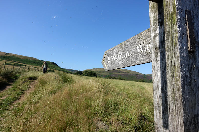
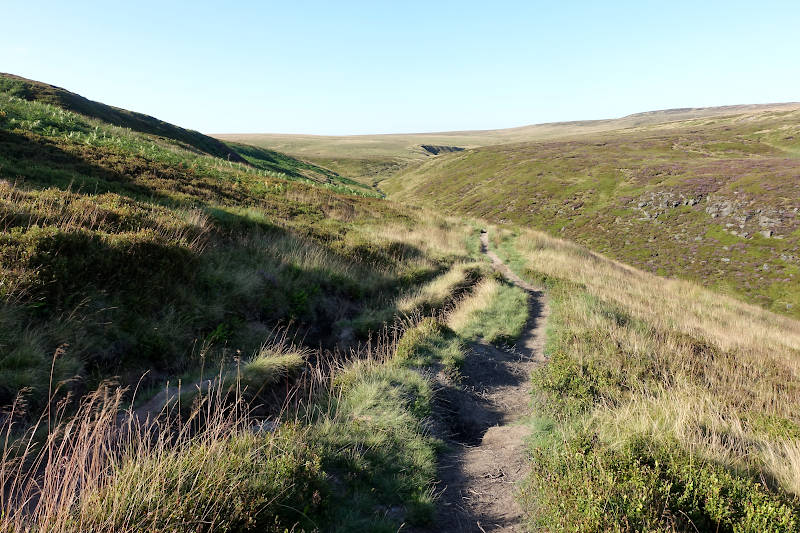
The first half of the route follows the Pennine Way, in fact all the way to the days high-point of Black Hill. It was to my surprise therefore that despite this and the great weather (did I mention the SUNNY weather ?!) I only bumped into a handful of people on the day, including one extremely joyous human being – more on him later.
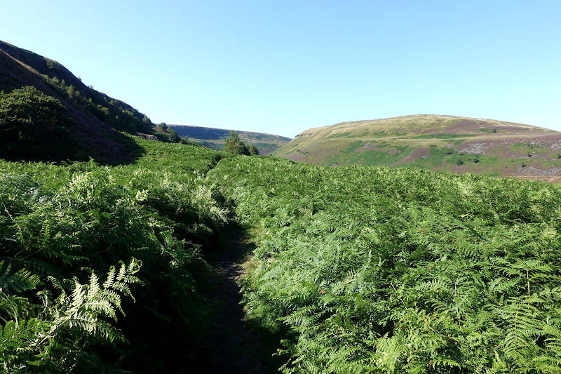
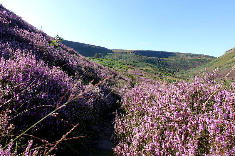
The opportunity to tick off a decent section of the Pennine Way on a circular walk is one is the big pulls of this route. As is getting upfront and personal with some quintessentially Peak District flora, namely an abundance of heather and fern which sprawled onto the path in parts.
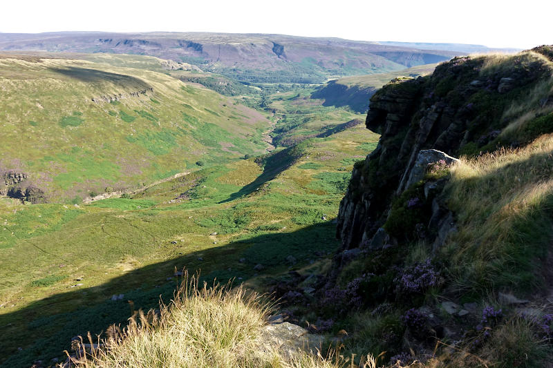
Laddow Rocks
Lofty Laddow Rocks towers over Crowden valley at over 500m. The views here are spectacular and arguably the best on the walk. The gritstone crag is a somewhat popular climbing location (albeit in Peak District terms its quiet), confirmed by a couple of geezers I momentarily observed scaling a pretty intimidating looking route.
Black Hill
One is teased by glimpses of Black Hill throughout the first half of the walk, I say teased as at times I think that’s what I was observing. This is because I was unfamiliar with the area and also because Black Hill as I was to discover is not the most distinctive of peaks. Hill by name, hill by nature!
The approach to Black Hill was pretty protracted, and with my water supply running low I increased the pace to a semi-jog with the intention of resting at the summit.
It was on this semi-jog where I bumped into one of the most memorable characters I have encountered in some time. A heavily tattooed and excitable being, he reeled off his backstory, recent walks, gym routine (which apparently started daily at 4.00am), warned me of a rather deep bog he had somehow just been semi-submerged in, and a whole host of other random utterings. After 10 mins of chatter I initiated a somewhat abrupt exit strategy – I was keen to get to the summit!
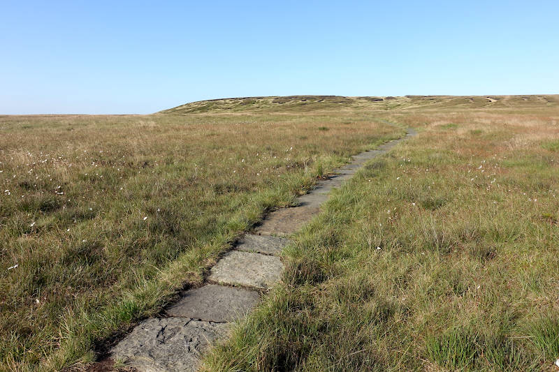
The final approach to Black Hill was I thought quite steep (comparable to other sections of the walk), albeit easy underfoot due to the rock slabbed path leading the way.
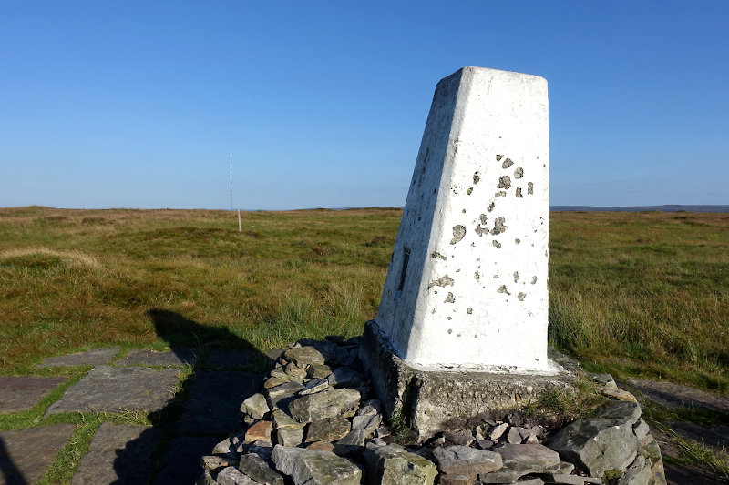
Black Hill rises to an elevation of 582 m, its summit marked by a trig point. A broad plateau its an unremarkable kind of place really, and lacks the kind of view I was hoping for (hence my previous comment on Laddow Rocks) – that kind of elevated vista where one can relax into a semi-slumber and consume ones partially crushed and body temperature warm sandwich!
Anyhow I completed the latter and got on my way sharpish, initially in the direction of the Holme Moss transmitter aerial – which it turns out is a good reference point for the walk overall.
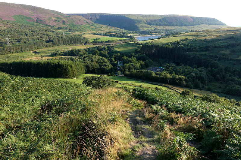
Crowden descent
The route back to base is over moorland initially, before the final descent proper which presents extensive views of the surrounding landscape. I semi-ran back as I had no water left by now, and was in general hot and bothered – hence it was head down pretty much until I knew the car was in touching distance!
Conclusion
I’ve hammered Kinder Scout and the Great Ridge over the years and am therefore on a conscious mission to explore elsewhere, and in the process expand my Peak District Walking Guide. This walk dropped on my radar for that very reason, and indeed because Black Hill is the third highest peak in the Peak District National Park.
The walk offers some pretty awesome views (in particular from Laddow Rocks) and allows you to tick off a section of the Pennine Way in the process. My advice is to tackle this walk during the summer months when the Heather and Fern are in full bloom, and the underfoot conditions are favourable. Tackle in the winter at your peril! Either way I’m sure you’ll have a blast!
Hazards
I did this walk in mid-summer, albeit it had been a very wet period and underfoot conditions in parts was extremely wet with extensive areas of gloopy and deep mud/peat?. There are also a number of stream crossings to consider. I can imagine this to be a very bleak and wet place in the winter time, and therefore personally I wouldn’t be doing this walk in the winter or after particularly wet periods. In low visibility navigation could also be a challenge – a good reason to brush up on your compass skills!
Remember – we cannot highlight all potential hazards when out in the great outdoors. Safety is ultimately down to you. Educate yourself in safety, weather reports, navigation and equipment specific to the activity you intend to undertake and conditions/terrain you may encounter! Check out adventuresmart.uk for general outdoor safety considerations – and activity specific guidance for hill walking, paddle boarding, mountain biking and open water swimming.